|
|
|
|
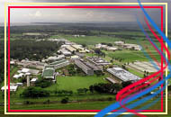
Laguna Geography
Laguna Islands Philippines
Land Area
 Laguna Island Philippines has a total area of 175,973 hectares (or about 1,759.7 square kms.), the third largest province in Region IV. Its size is approximately 3.75 percent of the whole Region IV and about 0.58 percent of the total land area of the country. The provincial capital is Santa Cruz. Laguna Island Philippines has a total area of 175,973 hectares (or about 1,759.7 square kms.), the third largest province in Region IV. Its size is approximately 3.75 percent of the whole Region IV and about 0.58 percent of the total land area of the country. The provincial capital is Santa Cruz.
Eighteen of the twenty-nine municipalities of Laguna belong to the coastal zone namely: San Pedro, Biñan, Santa Rosa, Cabuyao, Calamba City, Los Baños, Bay, Calauan, Victoria, Pila, Santa Cruz, Lumban, Kalayaan, Pangil, Pakil, Paete, Siniloan and Mabitac. It has a total coastal length of 109.2 kms. or about 49.64 percent of the total coastal length of Laguna de Bay. A total coastal zone area of 580.2 sq. kms. or 57.37 hectares is also present.
Land Classification
About 126,662, or about 72 percent, of the 175,973 hectares total land area of Laguna have been classified and certified either as alienable and disposable and 49,311 hectares, or 38 percent, forest lands. Of the alienable and disposable lands, 86,062 hectares, or 48.9 percent, are agricultural; 2,105 hectares, or 1.5 percent, industrial; 1,804 hectares, or one percent, commercial; and 36,691 hectares, or 20.9 percent, residential. Of the forest lands, 1,379 hectares (.8 percent), timberland; 5,000 hectares (2.8 percent), timber licenses area; 11,999 (6.8 percent), forest reserves; 3,305 hectares (1.9 percent), national park; 4,600 hectares (2.6 percent), civil reservations; 3,592 hectares (two percent), UPLB Mt. Makiling Botanical Garden; 17,236 hectares (9.8 percent) ISP Project; and 2,200 hectares (1.3 percent), agro forestry project.
|